
Jurong River topographic map
Interactive map
Click on the map to display elevation.
About this map
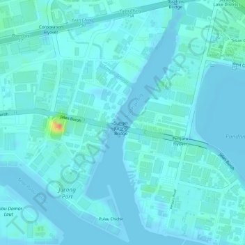
Name: Jurong River topographic map, elevation, terrain.
Location: Jurong River, Jurong East, Southwest, Singapore (1.30026 103.72323 1.32637 103.73413)
Average elevation: 7 m
Minimum elevation: -2 m
Maximum elevation: 52 m
Other topographic maps
Click on a map to view its topography, its elevation and its terrain.
Pandan Reservoir
Singapore > Southwest > Jurong East
Pandan Reservoir, Jurong East, Southwest, Singapore
Average elevation: 6 m