
Make a donation
Sungai Chenderoh topographic map
Click on the map to display elevation.
Make a donation
About this map
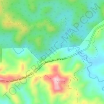
Name: Sungai Chenderoh topographic map, elevation, terrain.
Location: Sungai Chenderoh, Lojing, Gua Musang, Kelantan, Malaysia (4.72174 101.60858 4.72735 101.62949)
Average elevation: 311 m
Minimum elevation: 223 m
Maximum elevation: 469 m
Make a donation
Other topographic maps
Click on a map to view its topography, its elevation and its terrain.
Make a donation
Make a donation
Make a donation
Make a donation
Make a donation
Make a donation
Make a donation
Gunung Stong
The mountain features hill dipterocarp, upper dipterocarp and montane forests, as the elevation gradually increases. There is an abundance of flora containing beneficial and medicinal properties that can be obtained within these forests.
Average elevation: 1,105 m
Make a donation
Make a donation
Kelantan River
The river's tributaries rise in the forested mountains in the Gua Musang region in southern Kelantan, where many Orang Asli tribes live. The area is known for its karst topography, dotted with mogotes with numerous caves beneath them. Some cave systems along the Nenggiri River, the river's left tributary, show…
Average elevation: 71 m
Make a donation
Make a donation
Make a donation
Make a donation
Make a donation
Make a donation
Make a donation
Make a donation
Make a donation
Make a donation
Make a donation
Make a donation
Make a donation
Kelantan River
The river's tributaries rise in the forested mountains in the Gua Musang region in southern Kelantan, where many Orang Asli tribes live. The area is known for its karst topography, dotted with mogotes with numerous caves beneath them. Some cave systems along the Nenggiri River, the river's left tributary, show…
Average elevation: 71 m
Make a donation
Make a donation
Make a donation