
Thank you for supporting this site ❤️
Make a donation
Make a donation
Asana topographic map
Click on the map to display elevation.
Thank you for supporting this site ❤️
Make a donation
Make a donation
About this map
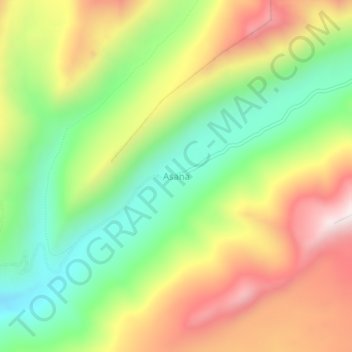
Name: Asana topographic map, elevation, terrain.
Location: Asana, Torata, Province of Mariscal Nieto, Moquegua, Peru (-17.08150 -70.54128 -17.04150 -70.50128)
Average elevation: 4,638 m
Minimum elevation: 4,266 m
Maximum elevation: 5,092 m
Thank you for supporting this site ❤️
Make a donation
Make a donation
Other topographic maps
Click on a map to view its topography, its elevation and its terrain.