
Make a donation
Humboldt County topographic map
Click on the map to display elevation.
Make a donation
About this map
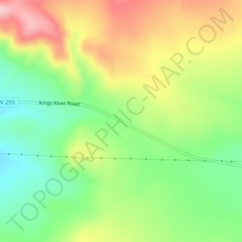
Name: Humboldt County topographic map, elevation, terrain.
Location: Humboldt County, Nevada, United States, Thacker Pass (41.70185 -118.07717 41.70195 -118.07707)
Average elevation: 1,521 m
Minimum elevation: 1,429 m
Maximum elevation: 1,636 m
Make a donation
Other topographic maps
Click on a map to view its topography, its elevation and its terrain.
Lake Mead
United States > Nevada > Clark County
At maximum capacity, Lake Mead is 112 miles (180 km) long, 532 feet (162 m) at its greatest depth, has a surface elevation of 1,221.4 feet (372.3 m) above sea level and 247 square miles (640 km2) of surface area, and contains 26.12 million acre feet (3.222×10¹³ L) of water.
Average elevation: 684 m
Valley of Fire State Park
Valley of Fire is located 50 miles (80 km) northeast of Las Vegas, at an elevation between 1,320–3,009 feet (402–917 m). It abuts the Lake Mead National Recreation Area on the east at the Virgin River confluence. It lies in a 4 by 6 mi (6.4 by 9.7 km) basin.
Average elevation: 614 m
Make a donation
Make a donation
Make a donation
Make a donation
Make a donation
Make a donation
Make a donation
Yerington
United States > Nevada > Lyon County
During the summer, temperatures are generally hot to very hot in the afternoon, but the high altitude and low humidity means temperature drop to a comfortable level at night. On average, 8.0 afternoons each summer will exceed 100 °F or 37.8 °C and 73.2 afternoons reach 90 °F (32.2 °C). It is rare, though,…
Average elevation: 1,358 m
Make a donation
Angel Lake
United States > Nevada > Elko County
Angel Lake is a glacial tarn in the northern part of the East Humboldt Range, in central Elko County in the northeastern part of the state of Nevada. It is located at approximately 41°01.6′N 115°05.1′W / 41.0267°N 115.0850°W / 41.0267; -115.0850, and at an elevation of 8378 feet (2553 m). It…
Average elevation: 2,672 m
Sand Harbor
United States > Nevada > Washoe County > Incline Village-Crystal Bay
Average elevation: 2,006 m
Make a donation
Make a donation
Dixie Valley - Fairview Peak 7.1 Earthquake 1954 Fault Line
United States > Nevada > Churchill County
Average elevation: 1,817 m
Make a donation
Carey–Lake Mead Detention Basin
United States > Nevada > Clark County > North Las Vegas
Average elevation: 648 m
Make a donation
Make a donation