
Amares topographic map
Interactive map
Click on the map to display elevation.
About this map
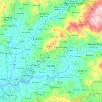
Name: Amares topographic map, elevation, terrain.
Location: Amares, Braga, Portugal (41.60324 -8.43386 41.70017 -8.24195)
Average elevation: 217 m
Minimum elevation: 20 m
Maximum elevation: 897 m
Other topographic maps
Click on a map to view its topography, its elevation and its terrain.