
15th district topographic map
Interactive map
Click on the map to display elevation.
About this map
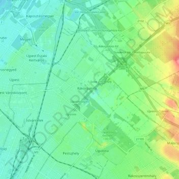
Name: 15th district topographic map, elevation, terrain.
Location: 15th district, Budapest, Central Hungary, Hungary (47.52585 19.10273 47.59985 19.18078)
Average elevation: 121 m
Minimum elevation: 100 m
Maximum elevation: 174 m
Other topographic maps
Click on a map to view its topography, its elevation and its terrain.
11th district
11th district, Budapest, Central Hungary, Hungary
Average elevation: 145 m