
11th district topographic map
Interactive map
Click on the map to display elevation.
About this map
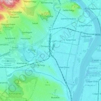
Name: 11th district topographic map, elevation, terrain.
Location: 11th district, Budapest, Central Hungary, Hungary (47.42776 18.96990 47.48868 19.06751)
Average elevation: 145 m
Minimum elevation: 93 m
Maximum elevation: 451 m
Other topographic maps
Click on a map to view its topography, its elevation and its terrain.
15th district
15th district, Budapest, Central Hungary, Hungary
Average elevation: 121 m