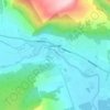
Ben More topographic map
Click on the map to display elevation.
Ben More
On 19 January 1973, a Vickers Viscount of British European Airways took off from Glasgow International Airport at about 14:20 on a test flight to be conducted at Flight Level (FL) 40; in the conditions prevailing at the time FL40 was equivalent to about 3,850 feet (1,173 m). At about 14:32 the aircraft flew into Ben More about 600 ft (180 m) northeast and 100 ft (30 m) below the summit while flying in a westerly direction. The two pilots and two passengers on board were killed in the accident. The Air Accidents Investigation Branch (AAIB) found that the aircraft struck Ben More whilst flying over snow-covered high terrain in marginal visual meteorological conditions and said that "Failure to maintain a safe altitude and insufficient attention to navigational procedures were contributory factors".
About this map

Name: Ben More topographic map, elevation, terrain.
Location: Ben More, Stirling, Scotland, United Kingdom (56.38596 -4.54011 56.38606 -4.54001)
Average elevation: 698 m
Minimum elevation: 204 m
Maximum elevation: 1,169 m
Other topographic maps
Click on a map to view its topography, its elevation and its terrain.

Loch Lomond and The Trossachs National Park
United Kingdom > Scotland > Stirling
The park straddles the Highland Boundary Fault, which divides it into two distinct regions - lowland and highland - that differ in underlying geology, soil types and topography. The change in rock type can most clearly be seen at Loch Lomond itself, as the fault runs across the islands of Inchmurrin, Creinch,…
Average elevation: 291 m