

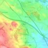
Loch Chon topographic map
Click on the map to display elevation.
About this map

Name: Loch Chon topographic map, elevation, terrain.
Location: Loch Chon, Stirling, Scotland, United Kingdom (56.20352 -4.55949 56.22554 -4.53482)
Average elevation: 242 m
Minimum elevation: 88 m
Maximum elevation: 502 m
Other topographic maps
Click on a map to view its topography, its elevation and its terrain.




Ben A'an
United Kingdom > Scotland > Stirling
Ben A'an is a hill in the Trossachs in Scotland. The pointed peak of its west top (454 metres or 1,490 feet in elevation) resembles a small mountain.
Average elevation: 283 m








Ben More
United Kingdom > Scotland > Stirling
On 19 January 1973, a Vickers Viscount of British European Airways took off from Glasgow International Airport at about 14:20 on a test flight to be conducted at Flight Level (FL) 40; in the conditions prevailing at the time FL40 was equivalent to about 3,850 feet (1,173 m). At about 14:32 the aircraft flew…
Average elevation: 698 m


