
Thank you for supporting this site ❤️
Make a donation
Make a donation
Georgetown topographic map
Click on the map to display elevation.
Thank you for supporting this site ❤️
Make a donation
Make a donation
About this map
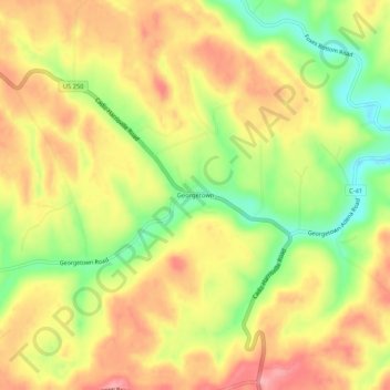
Name: Georgetown topographic map, elevation, terrain.
Location: Georgetown, Harrison County, Ohio, 43974, United States (40.18757 -80.94065 40.22757 -80.90065)
Average elevation: 334 m
Minimum elevation: 266 m
Maximum elevation: 389 m
Thank you for supporting this site ❤️
Make a donation
Make a donation
Other topographic maps
Click on a map to view its topography, its elevation and its terrain.
Thank you for supporting this site ❤️
Make a donation
Make a donation
Thank you for supporting this site ❤️
Make a donation
Make a donation