
Cork topographic map
Interactive map
Click on the map to display elevation.
About this map
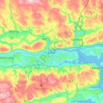
Name: Cork topographic map, elevation, terrain.
Location: Cork, County Cork, Munster, Ierland (51.82731 -8.63785 51.97014 -8.35513)
Average elevation: 79 m
Minimum elevation: -3 m
Maximum elevation: 197 m
Other topographic maps
Click on a map to view its topography, its elevation and its terrain.