
Bantry topographic map
Interactive map
Click on the map to display elevation.
About this map
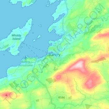
Name: Bantry topographic map, elevation, terrain.
Location: Bantry, West Cork, County Cork, Munster, P75 AE30, Ierland (51.63977 -9.49236 51.71977 -9.41236)
Average elevation: 67 m
Minimum elevation: -4 m
Maximum elevation: 280 m
Other topographic maps
Click on a map to view its topography, its elevation and its terrain.
Been
Been, Kilnamanagh, West Cork, County Cork, Munster, P75 K722, Ierland
Average elevation: 11 m