
Thank you for supporting this site ❤️
Make a donation
Make a donation
Praia da Rocha topographic map
Click on the map to display elevation.
Thank you for supporting this site ❤️
Make a donation
Make a donation
About this map
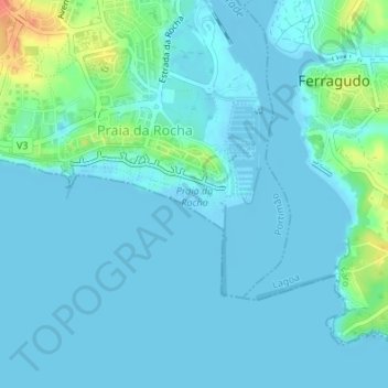
Name: Praia da Rocha topographic map, elevation, terrain.
Location: Praia da Rocha, Portimão, Faro, Portugal (37.11316 -8.54286 37.11813 -8.52951)
Average elevation: 7 m
Minimum elevation: -2 m
Maximum elevation: 46 m
Thank you for supporting this site ❤️
Make a donation
Make a donation
Other topographic maps
Click on a map to view its topography, its elevation and its terrain.