
Thank you for supporting this site ❤️
Make a donation
Make a donation
Abyei topographic map
Click on the map to display elevation.
Thank you for supporting this site ❤️
Make a donation
Make a donation
About this map
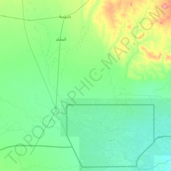
Name: Abyei topographic map, elevation, terrain.
Location: Abyei, West Kurdufan State, Sudan (9.34387 27.24801 11.48536 29.53750)
Average elevation: 435 m
Minimum elevation: 393 m
Maximum elevation: 860 m
Thank you for supporting this site ❤️
Make a donation
Make a donation
Other topographic maps
Click on a map to view its topography, its elevation and its terrain.