
Gallanagh topographic map
Interactive map
Click on the map to display elevation.
About this map
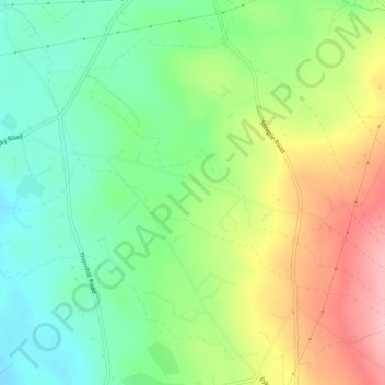
Name: Gallanagh topographic map, elevation, terrain.
Location: Gallanagh, Kells, County Antrim, Irlande du Nord, Royaume-Uni (54.77074 -6.23459 54.78874 -6.19021)
Average elevation: 118 m
Minimum elevation: 59 m
Maximum elevation: 206 m
Other topographic maps
Click on a map to view its topography, its elevation and its terrain.
Cullycapple
Royaume-Uni > Irlande du Nord > Kells
Cullycapple, Kells, County Antrim, Irlande du Nord, BT41 2LD, Royaume-Uni
Average elevation: 62 m
Fernisky
Royaume-Uni > Irlande du Nord > Kells
Fernisky, Kells, County Antrim, Irlande du Nord, Royaume-Uni
Average elevation: 89 m