
Thank you for supporting this site ❤️
Make a donation
Make a donation
Gunung Lang topographic map
Click on the map to display elevation.
Thank you for supporting this site ❤️
Make a donation
Make a donation
About this map
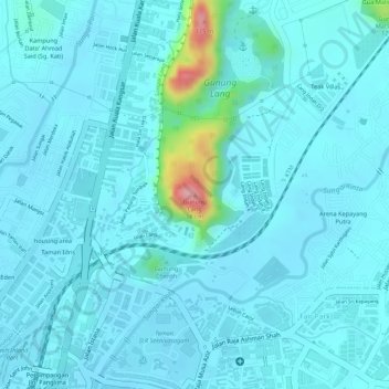
Name: Gunung Lang topographic map, elevation, terrain.
Location: Gunung Lang, Ipoh, Kinta, Perak, 30450, Malaysia (4.61419 101.08596 4.61429 101.08606)
Average elevation: 54 m
Minimum elevation: 37 m
Maximum elevation: 174 m
Thank you for supporting this site ❤️
Make a donation
Make a donation
Other topographic maps
Click on a map to view its topography, its elevation and its terrain.
Thank you for supporting this site ❤️
Make a donation
Make a donation
Thank you for supporting this site ❤️
Make a donation
Make a donation