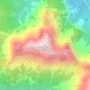
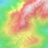
Bovec topographic map
Click on the map to display elevation.
About this map

Name: Bovec topographic map, elevation, terrain.
Location: Bovec, Slovenia (46.26599 13.39967 46.44671 13.83655)
Average elevation: 1,150 m
Minimum elevation: 170 m
Maximum elevation: 2,706 m
Other topographic maps
Click on a map to view its topography, its elevation and its terrain.

Ljubljana
Ljubljana has an elevation of 295 m (968 ft). The city centre, located along the river, sits at 298 m (978 ft). Ljubljana Castle, which sits atop Castle Hill (Grajski grič) south of the city centre, has an elevation of 366 m (1,201 ft). The highest point of the city, called Grmada, reaches 676 m (2,218 ft), 3…
Average elevation: 412 m




Dolnja Težka Voda
The names Dolnja Težka Voda and neighboring Gornja Težka Voda literally mean 'lower' and 'upper heavy water/creek', respectively. The name is derived from the creek north of the settlements, known as Težka voda (Heavy Creek), and was later transferred to the villages. The settlements were first recorded in…
Average elevation: 251 m


Soča
An Alpine river in character, its source lies in the Trenta Valley in the Julian Alps in northwestern Slovenia, at an elevation of 876 metres (2,874 ft). The river runs past the towns of Bovec, Kobarid, Tolmin, Kanal ob Soči, Nova Gorica (where it is crossed by the Solkan Bridge), and Gorizia, entering the…
Average elevation: 475 m


Triglav
Triglav (pronounced [ˈtɾiːɡlau̯]; German: Terglau; Italian: Tricorno), with an elevation of 2,863.65 metres (9,395.2 ft), is the highest mountain in Slovenia and the highest peak of the Julian Alps. The mountain is the pre-eminent symbol of the Slovene nation, appearing on the coat of arms and flag of…
Average elevation: 2,161 m


Ljubljana
Ljubljana has an elevation of 295 m (968 ft). The city centre, located along the river, sits at 298 m (978 ft). Ljubljana Castle, which sits atop Castle Hill (Grajski grič) south of the city centre, has an elevation of 366 m (1,201 ft). The highest point of the city, called Grmada, reaches 676 m (2,218 ft), 3…
Average elevation: 412 m

Karst
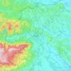
It lies between the Vipava Valley, the low hills surrounding the valley, the westernmost part of the Brkini Hills, northern Istria, and the Gulf of Trieste. The western edge of the plateau also marks the traditional ethnic border between Italians and Slovenes. The region gave its name to karst topography. For…
Average elevation: 423 m



Idrijski Log
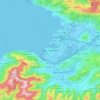
Idrijski Log lies on the north end of the Črni Vrh Plateau, which then drops sharply to the Idrijca Valley. It is connected to the hamlet of Podroteja in Idrija by a gravel road with a series of switchbacks and to Godovič by a route known as the French Road (Slovene: francoska cesta), which also leads to…
Average elevation: 642 m


Bovec
Bovec is located 136 kilometres (85 mi) from the capital Ljubljana, at an elevation of 434 m (1,424 ft). The settlement lies in the Bovec Basin of the upper Soča (Isonzo) River, below the eastern slopes of Mount Kanin in the Julian Alps, forming the border with Italy. The adjacent Trenta Valley in the…
Average elevation: 958 m




Ljubljana
Ljubljana has an elevation of 295 meters (968 ft) The city centre, located along the Ljubljanica River, has an elevation of 298 meters (978 ft). Ljubljana Castle, which sits atop Castle Hill (Grajski grič) south of the city centre, has an elevation of 366 meters (1,201 ft). The highest point of the city,…
Average elevation: 412 m

Murska Sobota
Annual rainfall in Murska Sobota is among the lowest in Slovenia. Characterized by the instability of rainfall, severe droughts are frequent. It has a warm-summer humid continental climate (Dfb) that is uncommon in Slovenia except at higher elevations,
Average elevation: 191 m

Triglav
Triglav (pronounced [ˈtɾiːɡlau̯]; German: Terglau; Italian: Tricorno), with an elevation of 2,863.65 metres (9,395 ft 2+1⁄8 in), is the highest mountain in Slovenia and the highest peak of the Julian Alps. The mountain is the pre-eminent symbol of the Slovene nation, appearing on the coat of arms and…
Average elevation: 2,161 m






Mangart
Mangart or Mangrt is a mountain in the Julian Alps, located on the border between Italy and Slovenia. With an elevation of 2,679 metres (8,789 ft), it is the fourth-highest peak in Slovenia, after Triglav, Škrlatica and Mali Triglav. It was first climbed in 1794 by the naturalist Franz von Hohenwart. Mangart…
Average elevation: 1,800 m

Velika Planina
Velika Planina (pronounced [ˈʋéːlika plaˈnìːna] pronunciation; literally 'big pasture') is a dispersed high-elevation settlement of mostly herders' dwellings on the karst Big Pasture Plateau in the Kamnik Alps in Upper Carniola region of Slovenia.
Average elevation: 1,306 m


Kras
It lies between the Vipava Valley, the low hills surrounding the valley, the westernmost part of the Brkini Hills, northern Istria, and the Gulf of Trieste. The western edge of the plateau also marks the traditional ethnic border between Italians and Slovenes. The region gave its name to karst topography. For…
Average elevation: 423 m
Triglav
Triglav (pronounced [ˈtɾíːɡlaw]; German: Terglau; Italian: Tricorno), with an elevation of 2,863.65 metres (9,395 ft 2+1⁄8 in), is the highest mountain in Slovenia and the highest peak of the Julian Alps. The mountain is the pre-eminent symbol of the Slovene nation, appearing on the coat of arms and…
Average elevation: 2,161 m


Triglav
Triglav (pronounced [ˈtɾíːɡlaw]; German: Terglau; Italian: Tricorno), with an elevation of 2,863.65 metres (9,395 ft 2+1⁄8 in), is the highest mountain in Slovenia and the highest peak of the Julian Alps. The mountain is the pre-eminent symbol of the Slovene nation, appearing on the coat of arms and…
Average elevation: 2,161 m