
Pulau Togean topographic map
Interactive map
Click on the map to display elevation.
About this map
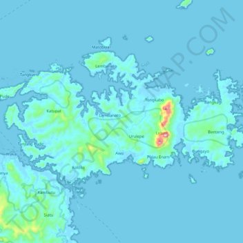
Name: Pulau Togean topographic map, elevation, terrain.
Location: Pulau Togean, Tojo Una-Una, Sulteng, Indonesië (-0.44381 121.85893 -0.32335 122.06547)
Average elevation: 21 m
Minimum elevation: -3 m
Maximum elevation: 495 m
Other topographic maps
Click on a map to view its topography, its elevation and its terrain.
Taman Nasional Lore Lindu
Taman Nasional Lore Lindu, Dodolo, Poso, Sulteng, Indonesië
Average elevation: 1,124 m