
Santo Tomás topographic map
Interactive map
Click on the map to display elevation.
About this map
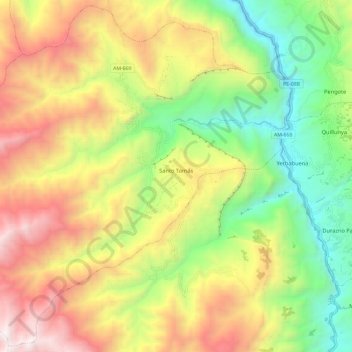
Name: Santo Tomás topographic map, elevation, terrain.
Location: Santo Tomás, Luya, Amazonas, Peru (-6.63165 -77.94510 -6.51831 -77.82727)
Average elevation: 2,736 m
Minimum elevation: 1,924 m
Maximum elevation: 3,727 m
Other topographic maps
Click on a map to view its topography, its elevation and its terrain.