
Department of Amazonas topographic map
Interactive map
Click on the map to display elevation.
About this map
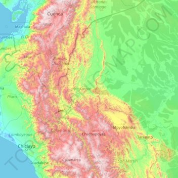
Name: Department of Amazonas topographic map, elevation, terrain.
Location: Department of Amazonas, Amazonas, Peru (-7.60000 -80.60000 -2.40000 -75.40000)
Average elevation: 928 m
Minimum elevation: -5 m
Maximum elevation: 4,491 m
Other topographic maps
Click on a map to view its topography, its elevation and its terrain.
Cerro Azul
Peru > Amazonas > Bagua Grande > Cerro Azul
Cerro Azul, Bagua Grande, Province of Utcubamba, Amazonas, Peru
Average elevation: 2,159 m