
Thank you for supporting this site ❤️
Make a donation
Make a donation
Zhuzhou topographic map
Click on the map to display elevation.
Thank you for supporting this site ❤️
Make a donation
Make a donation
About this map
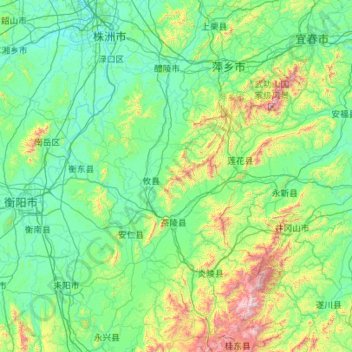
Name: Zhuzhou topographic map, elevation, terrain.
Location: Zhuzhou, Hunan, China (26.04305 112.96396 28.02761 114.10470)
Average elevation: 274 m
Minimum elevation: 27 m
Maximum elevation: 2,085 m
Thank you for supporting this site ❤️
Make a donation
Make a donation
Other topographic maps
Click on a map to view its topography, its elevation and its terrain.