
Make a donation
Ávila topographic map
Click on the map to display elevation.
Make a donation
Ávila
Ávila's position results in a warm summer mediterranean climate (Csb, according to the Köppen climate classification) bordering on a cold semi-arid climate (BSk) with warm summers and chilly winters with snowfalls. The hottest month, July, has an average temperature of 20.6 °C (69 °F), and the coldest month, January, has an average of 3.0 °C (37 °F). The average annual precipitation is 416 mm (16.38 in). Annual rainfall is low compared to surrounding areas, implying that it lies in a rain shadow. The Adaja is dry for several months of the year and the town has historically had water supply problems. Ávila has the coldest winter low temperatures of the Spanish provincial capital cities, thanks to its high altitude (1,132 metres (3,714 ft) above sea level).
Make a donation
About this map
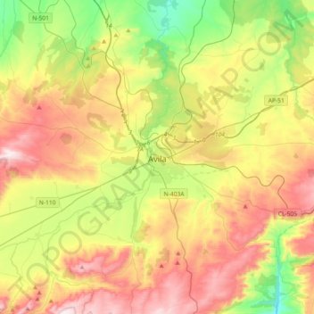
Name: Ávila topographic map, elevation, terrain.
Location: Ávila, Castile and León, Spain (40.56076 -4.81645 40.75367 -4.45361)
Average elevation: 1,157 m
Minimum elevation: 840 m
Maximum elevation: 1,555 m
Make a donation
Other topographic maps
Click on a map to view its topography, its elevation and its terrain.
Make a donation
Make a donation
Make a donation
Make a donation
Sierra de Guadarrama
The range runs southwest–northeast, extending from the province of Ávila in the southwest, through the Community of Madrid, to the province of Segovia in the northeast. The range measures approximately 80 kilometres (50 mi) in length. Its highest peak is Peñalara, 2,428 metres (7,966 ft) in elevation.
Average elevation: 1,153 m
Make a donation
Make a donation
Make a donation
Make a donation
Make a donation
Make a donation
Make a donation
Make a donation
Yacimiento arqueológico La Edrada
Spain > Castile and León > El Bierzo > Cacabelos
Average elevation: 493 m
Make a donation
Make a donation
Make a donation
Make a donation
Make a donation
Make a donation
Make a donation
Make a donation
Make a donation
Poblado del Salto de Aldeadávila
Spain > Castile and León > Aldeadávila de la Ribera
Average elevation: 535 m
Make a donation
Make a donation
Make a donation
Make a donation