
Kangding topographic map
Interactive map
Click on the map to display elevation.
About this map
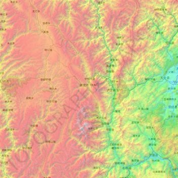
Name: Kangding topographic map, elevation, terrain.
Location: Kangding, 甘孜藏族自治州, Sichuan, 626000, China (29.13707 101.00495 30.77444 102.49227)
Average elevation: 3,330 m
Minimum elevation: 658 m
Maximum elevation: 7,247 m
Other topographic maps
Click on a map to view its topography, its elevation and its terrain.
འབར་ཁམས་རྫོང་ 马尔康市
འབར་ཁམས་རྫོང་ 马尔康市, 阿坝藏族羌族自治州, Sichuan, China
Average elevation: 3,858 m
银多乡
China > Sichuan > ཉག་རོང་རྫོང་ 新龙县
银多乡, ཉག་རོང་རྫོང་ 新龙县, 甘孜藏族自治州, Sichuan, China
Average elevation: 4,340 m