
Pitești topographic map
Interactive map
Click on the map to display elevation.
About this map
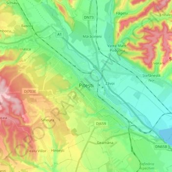
Name: Pitești topographic map, elevation, terrain.
Location: Pitești, Argeș, Roumanie (44.81748 24.78039 44.89582 24.94267)
Average elevation: 314 m
Minimum elevation: 243 m
Maximum elevation: 442 m
Other topographic maps
Click on a map to view its topography, its elevation and its terrain.