
Curtea de Argeș topographic map
Interactive map
Click on the map to display elevation.
About this map
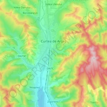
Name: Curtea de Argeș topographic map, elevation, terrain.
Location: Curtea de Argeș, Argeș, Roumanie (45.09072 24.59973 45.17998 24.74072)
Average elevation: 517 m
Minimum elevation: 379 m
Maximum elevation: 761 m
Other topographic maps
Click on a map to view its topography, its elevation and its terrain.