
Topoloveni topographic map
Interactive map
Click on the map to display elevation.
About this map
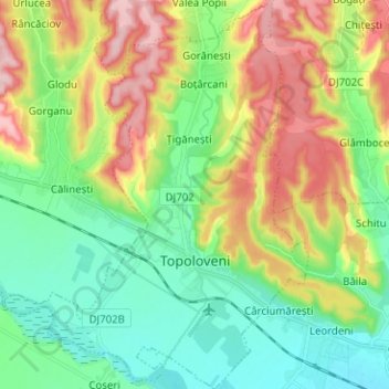
Name: Topoloveni topographic map, elevation, terrain.
Location: Topoloveni, Argeș, Roumanie (44.77828 25.02359 44.86756 25.12202)
Average elevation: 282 m
Minimum elevation: 218 m
Maximum elevation: 393 m
Other topographic maps
Click on a map to view its topography, its elevation and its terrain.