
Make a donation
Upton County topographic map
Click on the map to display elevation.
Make a donation
Upton County
According to the U.S. Census Bureau, the county has a total area of 1,242 square miles (3,220 km2), of which 0.2 square miles (0.52 km2) (0.01%) is covered by water. The Spraberry Trend, the third-largest oil field in the United States by remaining reserves, underlies much of the county. Bobcat Hills, a summit with an elevation of 2,697 ft (822 m), is found in Upton County.
Make a donation
About this map
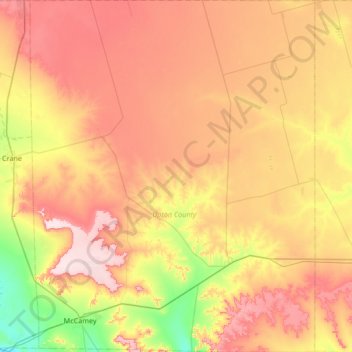
Name: Upton County topographic map, elevation, terrain.
Location: Upton County, Texas, United States (31.07976 -102.31789 31.65164 -101.77498)
Average elevation: 825 m
Minimum elevation: 695 m
Maximum elevation: 958 m
Make a donation
Other topographic maps
Click on a map to view its topography, its elevation and its terrain.
Make a donation
Make a donation
Make a donation
Make a donation
Make a donation
Enchanted Rock
United States > Texas > Llano County
Enchanted Rock is a pink granite mountain located in the Llano Uplift about 17 miles (27 km) north of Fredericksburg, Texas and 24 miles (39 km) south of Llano, Texas, United States. Enchanted Rock State Natural Area, which includes Enchanted Rock and surrounding land, spans the border between Gillespie and…
Average elevation: 453 m
Make a donation
Make a donation
Make a donation
Make a donation
Resaca De La Palma State Park
United States > Texas > Cameron County > Brownsville
Average elevation: 12 m
Belton
United States > Texas > Bell County
Belton is located 60 miles (97 km) north of Austin, 137 miles (220 km) south of Dallas, and 184 miles (296 km) west of Houston. It is near the center of Bell County at 31°3′32″N 97°27′48″W / 31.05889°N 97.46333°W / 31.05889; -97.46333 (31.058904, –97.463382). It is at the point where the…
Average elevation: 179 m
Make a donation
Soil Conservation Service Site 12 Dam
United States > Texas > Williamson County > Type
Average elevation: 173 m
Make a donation
Make a donation
Make a donation
Make a donation
Make a donation
Make a donation
Make a donation
Dallas
United States > Texas > Dallas County > Dallas
Dallas and its surrounding area are mostly flat. The city lies at elevations ranging from 450 to 550 feet (137 to 168 m) above sea level. The western edge of the Austin Chalk Formation, a limestone escarpment (also known as the "White Rock Escarpment"), rises 230 feet (70 m) and runs roughly north–south…
Average elevation: 158 m
Make a donation
Burkburnett
United States > Texas > Wichita County > Burkburnett > Burkburnett
Average elevation: 314 m
Make a donation
Galveston
United States > Texas > Galveston County > Galveston
On September 8, 1900, the island was struck by a devastating hurricane. This event holds the record as the United States' deadliest natural disaster. The city was devastated, and an estimated 6,000 to 8,000 people on the island were killed. Following the storm, a 10-mile (16 km) long, 17 foot (5.2 m) high…
Average elevation: 1 m
Make a donation
Plano
United States > Texas > Collin County > Plano
At first, Plano's population grew slowly, reaching 1,304 in 1900 and 3,695 in 1960. By 1970, Plano began to feel some of the boom its neighbors had experienced after World War II. A series of public works projects and a change in taxes that removed the farming community from the town helped increase the…
Average elevation: 181 m
Make a donation
Amarillo
United States > Texas > Potter County > Amarillo
Extreme temperatures range from −16 °F (−26.7 °C) on February 12, 1899 to 111 °F (43.9 °C) on June 26, 2011, but lows do not typically dip to 0 °F or −17.8 °C in most years, while highs above 100 °F or 37.8 °C are seen on 4.7 days on average. On average, there are 5.9 days of lows at or below 10…
Average elevation: 1,090 m
Make a donation
Make a donation
Make a donation
Make a donation