
Thank you for supporting this site ❤️
Make a donation
Make a donation
Sungei Punggol topographic map
Click on the map to display elevation.
Thank you for supporting this site ❤️
Make a donation
Make a donation
About this map
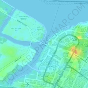
Name: Sungei Punggol topographic map, elevation, terrain.
Location: Sungei Punggol, Seletar, Central, 821325, Singapore (1.41439 103.89709 1.41489 103.89733)
Average elevation: 8 m
Minimum elevation: -4 m
Maximum elevation: 43 m
Thank you for supporting this site ❤️
Make a donation
Make a donation
Other topographic maps
Click on a map to view its topography, its elevation and its terrain.