Geolocate

洛龙街道 topographic map

Interactive map

Click on the map to display elevation.

About this map

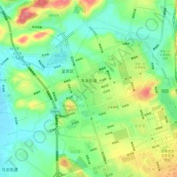
Name: 洛龙街道 topographic map, elevation, terrain.

Location: 洛龙街道, 呈贡区, 昆明市, 云南省, 中国 (24.86279 102.82229 24.90428 102.87746)

Average elevation: 1,925 m

Minimum elevation: 1,893 m

Maximum elevation: 1,976 m

Other topographic maps

Click on a map to view its topography, its elevation and its terrain.

三坝水库

中国 > 云南省 > 呈贡区 > 七甸街道

三坝水库, 七甸街道, 昆明阳宗海风景名胜区, 呈贡区, 昆明市, 云南省, 中国

Average elevation: 2,126 m

吴家营街道

中国 > 云南省 > 呈贡区

吴家营街道, 呈贡区, 昆明市, 云南省, 中国

Average elevation: 2,067 m

王家营村

中国 > 云南省 > 呈贡区

王家营村, 洛龙街道, 呈贡区, 昆明市, 云南省, 中国

Average elevation: 1,930 m

大渔街道

中国 > 云南省 > 呈贡区

大渔街道, 呈贡区, 昆明市, 云南省, 中国

Average elevation: 1,922 m

十八台

中国 > 云南省 > 呈贡区

十八台, 呈贡区, 云南省, 中国

Average elevation: 2,266 m

洛羊街道

中国 > 云南省 > 呈贡区

洛羊街道, 呈贡区, 云南省, 中国

Average elevation: 1,927 m

马金铺街道

中国 > 云南省 > 呈贡区 > 马金铺街道

马金铺街道, 呈贡区, 昆明市, 云南省, 中国

Average elevation: 2,001 m

泽湖

中国 > 云南省 > 呈贡区

泽湖, 吴家营街道, 呈贡区, 昆明市, 云南省, 中国

Average elevation: 1,953 m