
Nordland topographic map
Interactive map
Click on the map to display elevation.
About this map
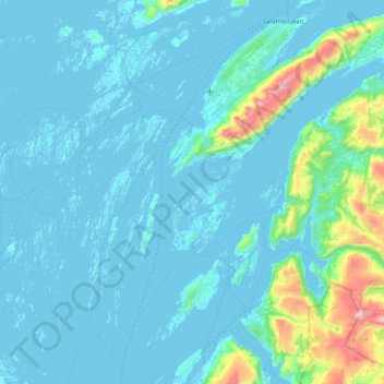
Name: Nordland topographic map, elevation, terrain.
Location: Alstahaug, Nordland, Noruega (65.69494 12.07128 66.03974 12.77499)
Average elevation: 101 m
Minimum elevation: -4 m
Maximum elevation: 1,157 m
Other topographic maps
Click on a map to view its topography, its elevation and its terrain.