
Andøya topographic map
Interactive map
Click on the map to display elevation.
About this map
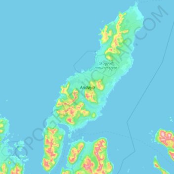
Name: Andøya topographic map, elevation, terrain.
Location: Andøya, Noruega (68.87102 15.41537 69.32807 16.17992)
Average elevation: 35 m
Minimum elevation: -2 m
Maximum elevation: 886 m
Other topographic maps
Click on a map to view its topography, its elevation and its terrain.