
France topographic map
Interactive map
Click on the map to display elevation.
France
France's topography presents a rich tapestry of varied landscapes, ranging from expansive plains to towering mountain ranges. In the north and west, the terrain is predominantly composed of flat plains and gently rolling hills, exemplified by the Paris Basin, which offers fertile soils ideal for agriculture. Contrastingly, the eastern and southern regions are marked by significant mountainous formations. The Alps in the east boast Mont Blanc, Western Europe's highest peak at 4,810 meters (15,781 feet), while the Pyrenees form a natural barrier along the Spanish border, characterized by rugged peaks and deep valleys. Central France is dominated by the Massif Central, an ancient highland region featuring a mix of plateaus and extinct volcanic peaks. Additionally, the Jura Mountains along the eastern frontier and the Vosges in the northeast contribute to the country's diverse elevation profile. France also boasts a lengthy coastline along the Atlantic Ocean, the Mediterranean Sea and the English Channel, with cliffs, sandy beaches, and rocky coves. The country’s varied topography contributes to its rich biodiversity, from alpine meadows to Mediterranean scrublands.
About this map
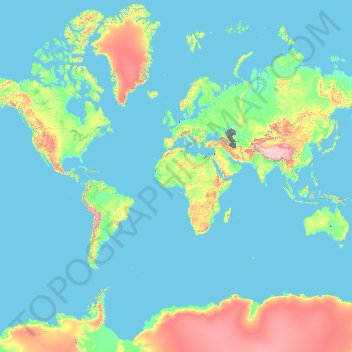
Name: France topographic map, elevation, terrain.
Location: France (-50.21872 -178.38737 51.30557 172.30572)
Average elevation: 430 m
Minimum elevation: -30 m
Maximum elevation: 6,542 m
Other topographic maps
Click on a map to view its topography, its elevation and its terrain.
Monviso
Italy > Piedmont > Cuneo > Pontechianale
Monte Viso is the location of a Neolithic jadeite quarry, at an elevation of 2,000 to 2,400 metres. Its productivity peaked around 5000 BC. The jadeite was used to make cult axes, which are found all over western Europe. One such ceremonial axe head was found as far away as a small hill called Tristia in…
Average elevation: 2,985 m
Ongole
India > Andhra Pradesh > Ongole
Ongole is located at 15.5°N 80.05°E. It has an average elevation of 10 m (33 ft) AMSL and is situated on the plains. The city is around 149 kilometres (93 mi) to the south west of Amaravati, the stat capital.
Average elevation: 15 m
Murree
Pakistan > Punjab > Murree District
Murree is a mountain resort city in the northernmost region of the Punjab province of Pakistan. Lying in the Galyat region of the Pir Panjal Range under the western Himalayas, it is located on the outskirts of the Islamabad–Rawalpindi metropolitan area. The town was built in the mid 19th-century and it…
Average elevation: 1,718 m
Hemu River
China > Xinjiang > Burqin County > Kom-Kanas Mongolian Ethnic Township
Average elevation: 1,732 m
Abbottabad
Pakistan > Khyber Pakhtunkhwa > Abbottābād District
Abbottabad is a city in the Hazara Division of Khyber Pakhtunkhwa province, Pakistan. It is the 40th largest city in the country and 6th largest in the province by population, and serves as the headquarter of its namesake tehsil and district. It is about 120 km (75 mi) north of Islamabad-Rawalpindi and 150 km…
Average elevation: 1,363 m
Argalasti
Greece > Thessaly and Central Greece > Regional Unit of Magnesia > Municipal unit of Argalasti
Average elevation: 226 m
Doha
Doha is located on the central-east portion of Qatar, bordered by the Persian Gulf on its coast. Its elevation is 10 m (33 ft). Doha is highly urbanized. Land reclamation off the coast has added 400 hectares of land and 30 km of coastline. Half of the 22 km² of surface area which Hamad International Airport…
Average elevation: 12 m
Mount Wudang
China > Hubei > Danjiangkou City
Modern maps show the elevation of the highest of the peaks in the Wudang Shan "proper" as 1612 meters; however, the entire Wudangshan range has somewhat higher elevations elsewhere.
Average elevation: 1,172 m
Les Rieux Vieux
France > Nouvelle-Aquitaine > Haute-Vienne > Saint-Pardoux-le-Lac
Average elevation: 380 m
Dingle
On March 8, 1820, with the support of 31 cabezas de barangay of the principalía or the hispanized Christian descendants of the pre-colonial datus of Dingle and certification of the parish priest of Laglag, Fray Juan Frayle, OSA (Dingle cura párroco, 1829–1849), a petition for the re-elevation of Dingle…
Average elevation: 49 m
Pico Duarte
Dominican Republic > Santiago > San José de las Matas
Pico Duarte is the highest peak in the Dominican Republic, on the island of Hispaniola and in all the Caribbean. At 3,101 m (10,174 ft) above sea level, it gives Hispaniola the 16th-highest maximum elevation of any island in the world. Additionally, it is only 85 kilometres (53 miles) northeast of the region's…
Average elevation: 2,750 m
Jijiga
Jijiga (Somali: Jigjiga, Amharic: ጅጅጋ, Jijiga) is the capital city of Somali Region, Ethiopia. It became the capital of the Somali Region in 1995 after it was moved from Gode. Located in the Fafan Zone with 75 km (37 mi) west of the border with Somaliland, the city has an elevation of 1,634 metres above…
Average elevation: 1,732 m
Phum Trapeang Svay
Cambodia > Phnom Penh > Khan Sen Sok > Sangkat Kouk Khleang
Average elevation: 11 m
Zona Central
Chile > Maule Region > Provincia de Curicó > Teno
The topography of central Chile includes a coastal range of mountains running parallel to the Andes. Lying between the two mountain ranges is the so-called Central Valley, which contains some of the richest agricultural land in the country, especially in its northern portion. The area just north and south of…
Average elevation: 1,121 m
Ascott
United Kingdom > England > Warwickshire > Stratford-on-Avon > Whichford
Average elevation: 160 m
Jiaming Lake
Taiwan > Taitung County > Haiduan
This oval-shaped lake is located along the Southern Cross-Island Highway. The lake surface is 120 meters long and 80 meters wide at an elevation of 3,310 meters. It is surrounded by emerald green forest plantation and wildlife. The area surrounds the lake has lodges and hiking trail with a length of 13 km.
Average elevation: 3,191 m