
Kamakura topographic map
Interactive map
Click on the map to display elevation.
About this map
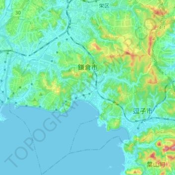
Name: Kamakura topographic map, elevation, terrain.
Location: Kamakura, Prefectura de Kanagawa, Japón (35.26656 139.48855 35.36822 139.59317)
Average elevation: 33 m
Minimum elevation: -1 m
Maximum elevation: 201 m
Other topographic maps
Click on a map to view its topography, its elevation and its terrain.