
Hita topographic map
Interactive map
Click on the map to display elevation.
About this map
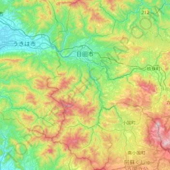
Name: Hita topographic map, elevation, terrain.
Location: Hita, Prefectura de Ōita, Japón (33.02292 130.82475 33.45768 131.09069)
Average elevation: 464 m
Minimum elevation: 15 m
Maximum elevation: 1,471 m
Other topographic maps
Click on a map to view its topography, its elevation and its terrain.