
宇治市 topographic map
Interactive map
Click on the map to display elevation.
About this map
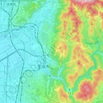
Name: 宇治市 topographic map, elevation, terrain.
Location: 宇治市, Prefectura de Kioto, Japón (34.85792 135.75965 34.95737 135.87992)
Average elevation: 139 m
Minimum elevation: -2 m
Maximum elevation: 570 m
Other topographic maps
Click on a map to view its topography, its elevation and its terrain.