
Atami topographic map
Interactive map
Click on the map to display elevation.
About this map
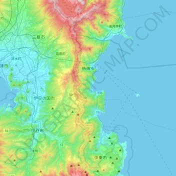
Name: Atami topographic map, elevation, terrain.
Location: Atami, Prefectura de Shizuoka, Región de Chūbu, Japón (34.95538 139.02785 35.15071 139.42076)
Average elevation: 184 m
Minimum elevation: 0 m
Maximum elevation: 1,080 m
Other topographic maps
Click on a map to view its topography, its elevation and its terrain.